Cordoba to Wellington flight path
Along the shortest route, the flight from Cordoba to Wellington covers 6,170 miles (9,930 km) — about 11 h 55 min with no wind. It passes over or close to Argentina, Chile and New Zealand. It crosses the Pacific Ocean and the Cook Strait: 88% of the route is over water. Today you leave on UTC−3 and land on UTC+13.
Get Modo Avión for Android Share this route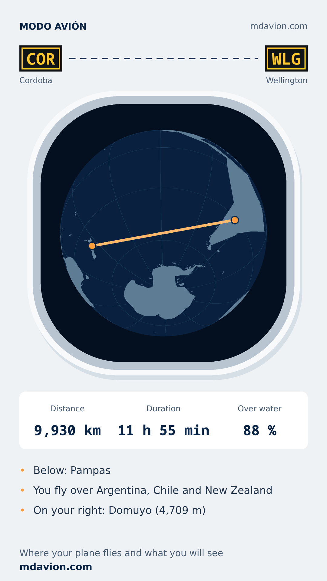
From Ingeniero Aeronáutico Ambrosio L.V. Taravella International Airport (COR) to Wellington International Airport (WLG) · COR · WLG
- Great-circle distance
- 9,930 km
- Duration, no wind
- 11 h 55 min
- Over water
- 88 %
- Time difference today
- +16 h
The route drawn is the theoretical one — the shortest path on the sphere. The real aircraft follows airways, avoids storms and closed airspace, and rides the wind: it can be hundreds of kilometres off.
What countries do you fly over from Cordoba to Wellington?
- Argentina
- Chile
- New Zealand
- Pacific Ocean
- Cook Strait
Which side of the plane to sit on to see Domuyo
To see Domuyo (4,709 m), sit on the right: it lies about 37 km from the route, ≈ 1 h 10 min into the flight.
- Villarrica Volcano (2,847 m) ≈ 1 h 35 min
- Tapuae-o-Uenuku (2,885 m) ≈ 11 h 40 min
- Mount Champaquí (2,770 m) ≈ 20 min
- Domuyo (4,709 m) ≈ 1 h 10 min
Left and right facing forward, on the theoretical route. Times are from take-off, with no wind.
Leg by leg
LandWaterCity, with its distance from the routePeakClock change
See the full list, leg by leg
- Take-off from Ingeniero Aeronáutico Ambrosio L.V. Taravella International Airport
- Below: Pampas0 km · ≈ 15 min into the flight
- Mount Champaquí, 2,770 m — on the right, 2 km away101 km · ≈ 20 min into the flight
- Below: Andes695 km · ≈ 1 h 05 min into the flight
- Domuyo, 4,709 m — on the right, 37 km away818 km · ≈ 1 h 10 min into the flight
- Below: Chilean Central Valley1,060 km · ≈ 1 h 30 min into the flight
- Villarrica Volcano, 2,847 m — on the left, 87 km away1,140 km · ≈ 1 h 35 min into the flight
- Pacific Ocean and Cook Strait — 8,700 km without land1,220 km · ≈ 1 h 40 min into the flight
- Below: Polynesia9,200 km · ≈ 10 h 50 min into the flight
- Below: New Zealand9,830 km · ≈ 11 h 35 min into the flight
- Local time below changes: UTC−3 to UTC+139,860 km · ≈ 11 h 35 min into the flight
- Landing at Wellington International Airport9,930 km · ≈ 11 h 40 min into the flight
- Tapuae-o-Uenuku, 2,885 m — on the left, 120 km away9,930 km · ≈ 11 h 40 min into the flight
Times assume a typical jet speed, no wind and an on-time departure. Good for orientation, not for your watch.
Which side the sun, sunrise or sunset will be on
Enter the day and take-off time. Your phone does the maths: the sun's position on every leg of the route, relative to the nose of the aircraft.
Sky: light is daytime, amber is sunrise or sunset, dark is night. Left and Right show which side the sun is on for each leg.
Follow the route offline in airplane mode
All of this on board and with no signal: with your phone in airplane mode, Modo Avión shows where you are, what's below and how long is left. GPS still works, because it only listens to satellites.
Free · no account · no ads · 28.4 MB · Android 8 or newer
Flight time and distance
About 11 h 55 min with no wind, including half an hour of taxi, climb and descent. On a long flight the wind aloft can change that by more than an hour, differently each way.
6,170 miles (9,930 km, 5,360 nautical miles) along the great circle. The real flight covers a little more because it follows airways.
Time zones you cross
| km | Time | Zone |
|---|---|---|
| 0 km | UTC−3 | Cordoba |
| 9,860 km | UTC+13 | Auckland |
Airspace (FIRs) along the route
Each is a control region: when the aircraft crosses the boundary, the centre talking to the pilot changes. Boundaries are approximate, from the VATSIM data set, not the official ICAO chart.
- Cordoba
- Mendoza
- Santiago
- Puerto Montt
- Punta Arenas
- Pascua
- Auckland Radio
- Christchurch (Taranaki)
FAQ
Where does the plane fly from Cordoba to Wellington?
Along the shortest route, the flight from Cordoba to Wellington covers 6,170 miles (9,930 km) — about 11 h 55 min with no wind. It passes over or close to Argentina, Chile and New Zealand. It crosses the Pacific Ocean and the Cook Strait: 88% of the route is over water. Today you leave on UTC−3 and land on UTC+13.
What countries do you fly over from Cordoba to Wellington?
It passes over or close to Argentina, Chile and New Zealand, and crosses the Pacific Ocean and the Cook Strait. This is the theoretical route: the aircraft may deviate for wind or closed airspace.
How long is the flight from Cordoba to Wellington?
About 11 h 55 min with no wind, including half an hour of taxi, climb and descent. On a long flight the wind aloft can change that by more than an hour, differently each way.
How far is Cordoba from Wellington by plane?
6,170 miles (9,930 km, 5,360 nautical miles) along the great circle. The real flight covers a little more because it follows airways.
How much of the flight is over water?
88% of the route, about 8,730 km. The longest stretch without land is 8,700 km.
Why doesn't the plane fly in a straight line on the map?
It does fly straight — on a sphere. On a flat map the shortest path looks curved; on the globe on this page it looks like what it is.
Does GPS work in airplane mode?
Yes. GPS is a receiver: it listens to satellites and transmits nothing, so it keeps working in airplane mode. What you won't have is a map unless you downloaded it; Modo Avión carries its own.
More routes
The way back: Wellington → Cordoba
Look up another route
How this was calculated
The route is the great-circle arc between both airports, split into 300 points. At each point a point-in-polygon test runs against 1,102 airspace regions, 418 time zones and 1,338 physical geography regions. Countries are those with a town within 25 km of the route: in empty areas one may be missing. Cities named have over 250,000 people and lie within 110 km.